
- TOP
- business
- Digital Twin Business
- Services for the Construction and Civil Engineering Industries
Services for the Construction and Civil Engineering Industries
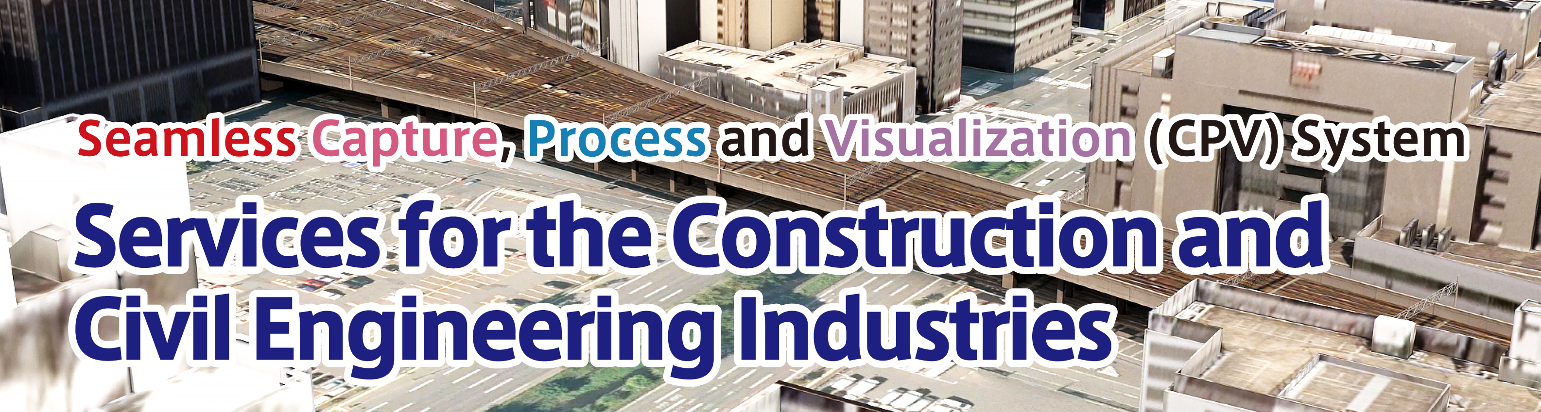
Our seamless CPV service is perfect as the transition is made to BIM/CIM
It was decided by Cabinet that BIM/CIM should be applied in principle to all public works projects, excluding small-scale construction, by FY2023.
KIMOTO is Based on the know-how of image processing and data processing technology cultivated since our founding, We provide a full range of BIM/CIM-related services including measurement (acquisition of data tailored to the purpose using laser scanners, UAVs, etc.), processing (creation and editing of 3D models from design and as-built drawings and point cloud data), and viewing (provision of content for attraction using perspective andAR).


Measurement <to measure>

Laser Measurement
We select equipment based on your objectives and requirements and conduct the measurements accordingly.
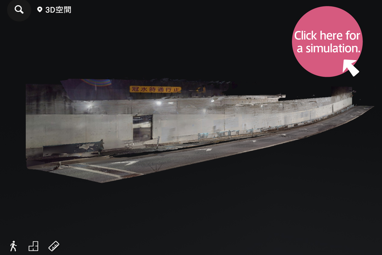
360-degree camera shooting
Using 360-degree cameras for photography and measurement, we provide clear 3D spaces in a short time.
▶
You can experience spaces as though you were really there, immersing yourself in the actual environment.

UAV Photography
We conduct on-site assessments with high-resolution, high-precision photography.
Source: National Institute of Advanced Industrial Science and Technology (AIST) Shot by our company using an oblique UAV.
Processing <to make>
BIM/CIM Data Creation "x to BIM/CIM"
We create BIM/CIM data from design and as-built drawings/point cloud data.
*x To BIM/CIM: A coined term by KIMOTO representing the creation of BIM/CIM from drawings or point cloud data. Based on the know-how of image processing and data processing technology cultivated since our founding, we support various data formats.
Creation of 3D models from drawings

Creation of 3D models from point cloud data

Compliance with BIM/CIM implementation guidelines
We can handle data creation for various classifications, such as structures and terrain. We also offer attribute assignment and design review (interference check) services.
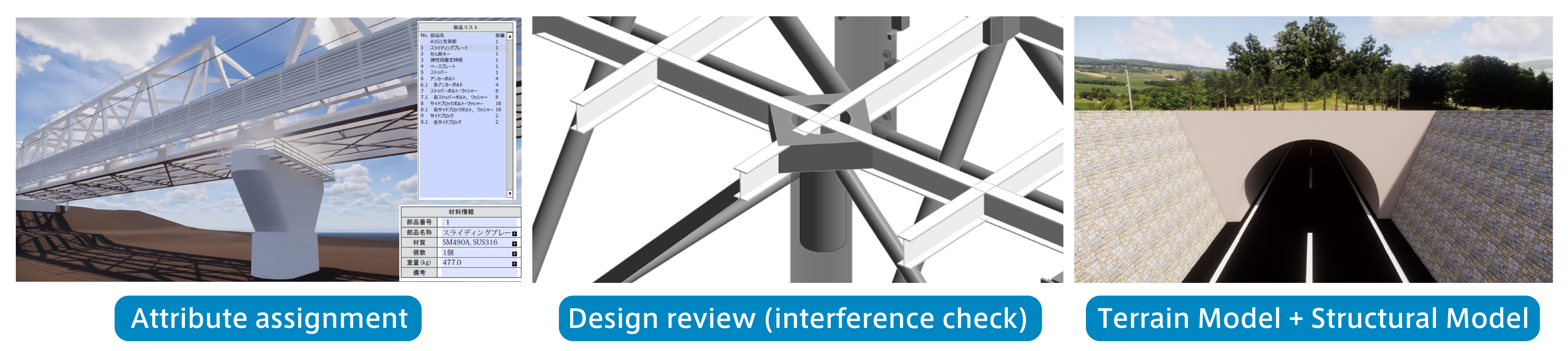
Compliance with the latest requirements
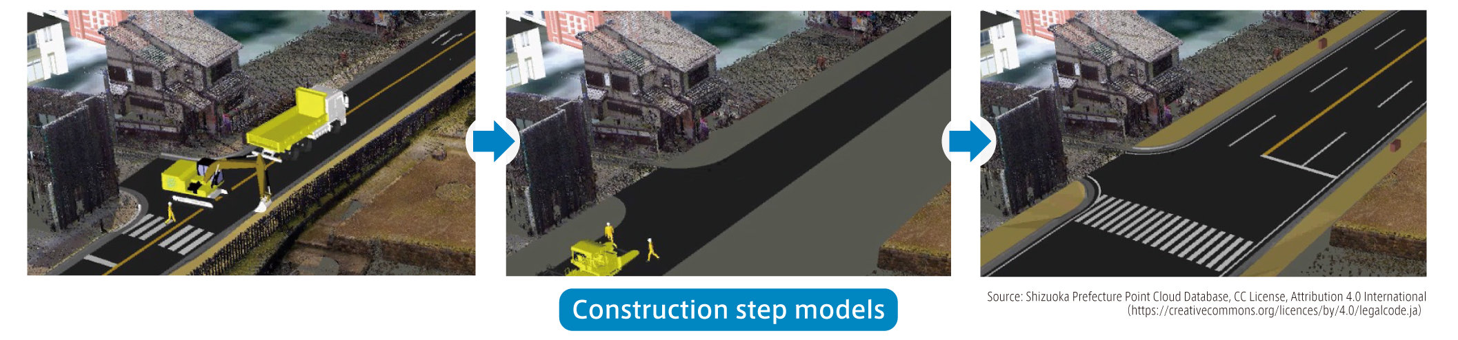
Evaluation of construction plans using 4D models: We can also create construction step models.
Estimation of approximate construction costs: We assist with tasks like calculating the number of reinforcing rods and quantifying earthworks for cost estimation.
KIMOTO Toolbar: Add-on Tool for Autodesk Civil 3D
"KIMOTO Toolbar" is an add-on software developed by KIMOTO for use with Civil 3D.
By using this tool to process large volumes of data in bulk, you can reduce the burden of data entry, minimize human errors, and improve operational efficiency.

CityGML Conversion Service
From various data formats to PLATEAU-compliant 3D city models.
The development of 3D city models is progressing nationwide in Japan through the "PLATEAU" project, a 3D city model initiative led by the Ministry of Land, Infrastructure, Transport and Tourism.
This service converts your various data into the CityGML format compliant with the 3D City Model Standard Product Specification (Version 4.0).
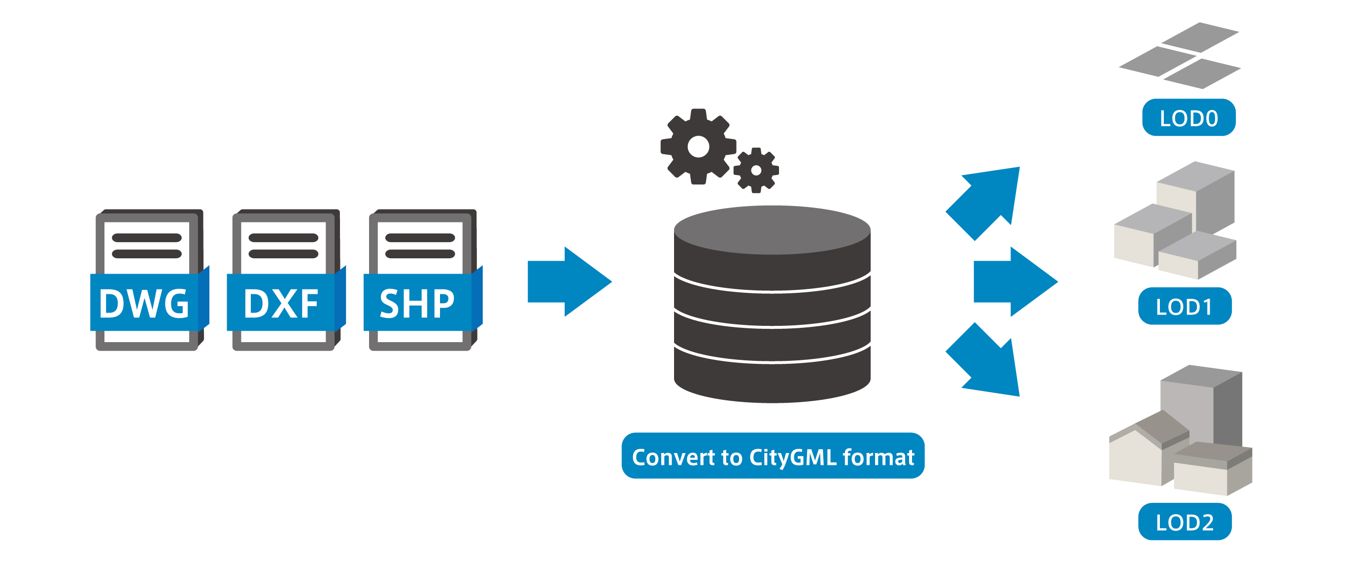
Supported formats
Input formats: DWG, DXF, SHP, etc. (Attribute information is also supported).
Delivery format: CityGML format (LOD0, LOD1, LOD2).
We also support conversion from CityGML format to various other formats.
Amid the growing need for PLATEAU compliance,
"We don't know how to convert existing CAD/GIS data to CityGML," and "Creating data according to the specifications is time-consuming and labor-intensive."
We support municipalities and businesses facing challenges such as "lacking in-house expertise in CityGML or PLATEAU."
Please feel free to consult with us.
For inquiries Here from
Service for Creating Plan Views and Longitudinal/Cross-Sectional Views from Point Cloud Data
We create plan and cross-sectional drawings that accurately capture the current conditions and can be directly utilized for design, maintenance, and various consultations.
In Japan, a country prone to many disasters, the use of UAVs (drones) and various laser surveying techniques in recovery and reconstruction work has been rapidly advancing in recent years.
Consequently, high-precision drawing creation utilizing point cloud data is becoming mainstream, alongside traditional surveying-based drawing creation.
At KIMOTO, we create various drawings such as plan views (topographic maps), longitudinal sections, and cross-sections based on point cloud data obtained through various measurement methods.
We can flexibly respond to sites affected by disasters and sites requiring rapid drawing creation.
Construction and civil engineering professionals who have point cloud data but face challenges in creating the drawings necessary for design and various consultations, please feel free to contact us for an initial consultation.
For inquiries Here from
Supported point cloud data

We support point cloud data obtained through various laser surveying methods, including terrestrial laser, airborne laser, mobile laser, UAV (drone) laser, and SLAM laser.
We can also handle post-measurement point cloud data processing, such as filtering and noise reduction.
Delivery Format
Data in DWG, DXF, and SFC formats
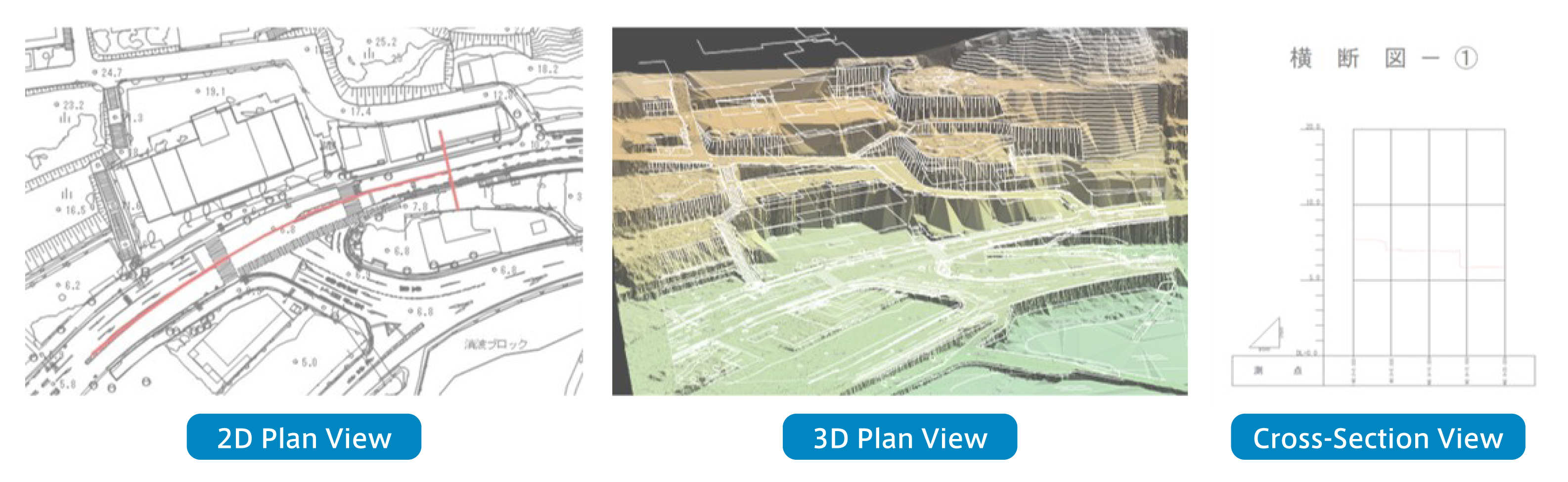
Drawing example
These are examples of 2D floor plans, 3D floor plans, and cross-sectional drawings created based on point cloud data.
3D Modeling Data for Construction Vehicles and Human Models
We offer versatile models for use in creating BIM/CIM construction steps.
Alternatively, we can create customized or new models.
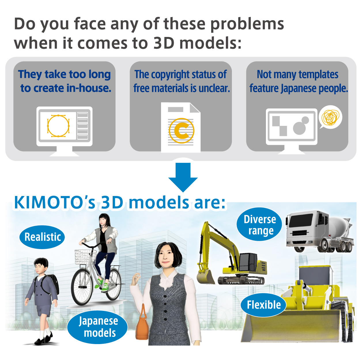
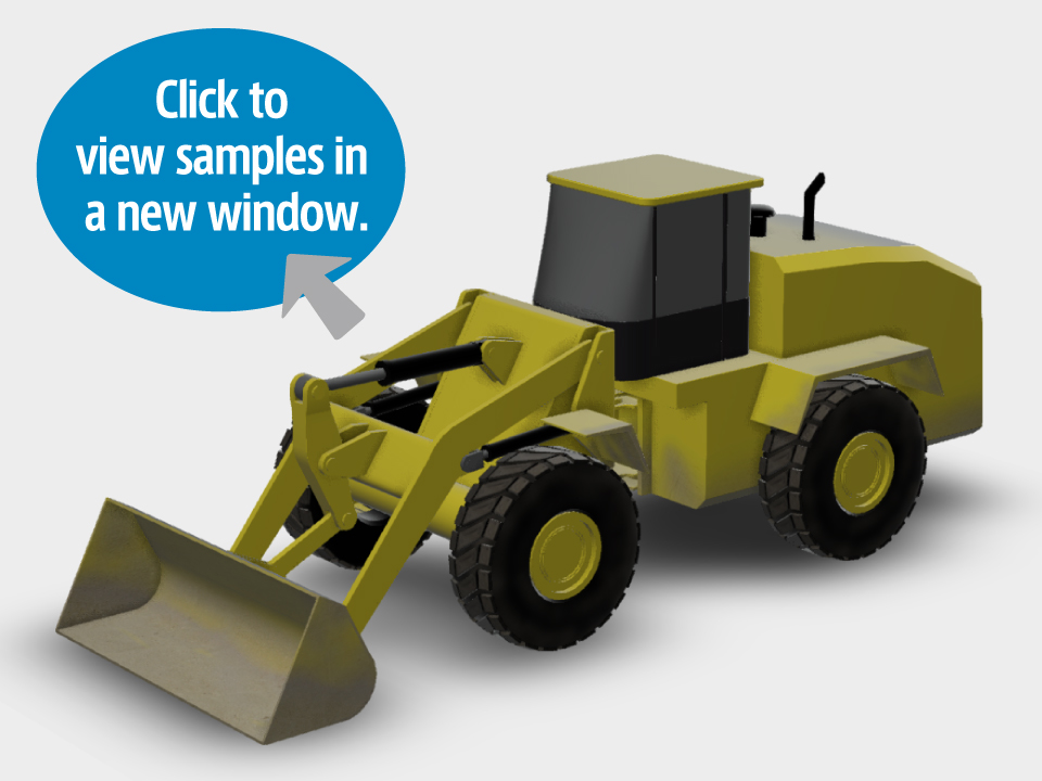
3D Construction Vehicle Models
It expresses the dirt and other aspects that are used in real situations, Reproduces parts that are hidden and not visible. You can freely change the posture and shape. Royalty-free material of realistic construction vehicles.
The page is From here
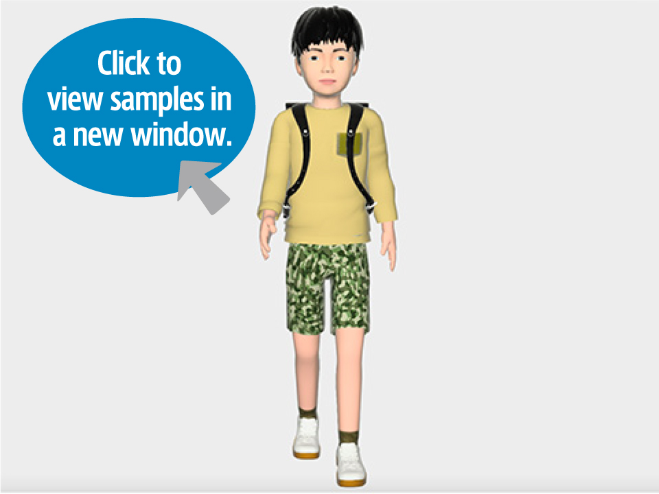
3D Human Models
Capturing the characteristics of Japanese people, these models blend in seamlessly when using free materials and provide a more realistic portrayal of 3D modeling data and AR videos. We offer a wide range of age groups and occupations.
The page is From here
Sample Models


View <view>
We provide captivating content using perspectives and AR, etc.
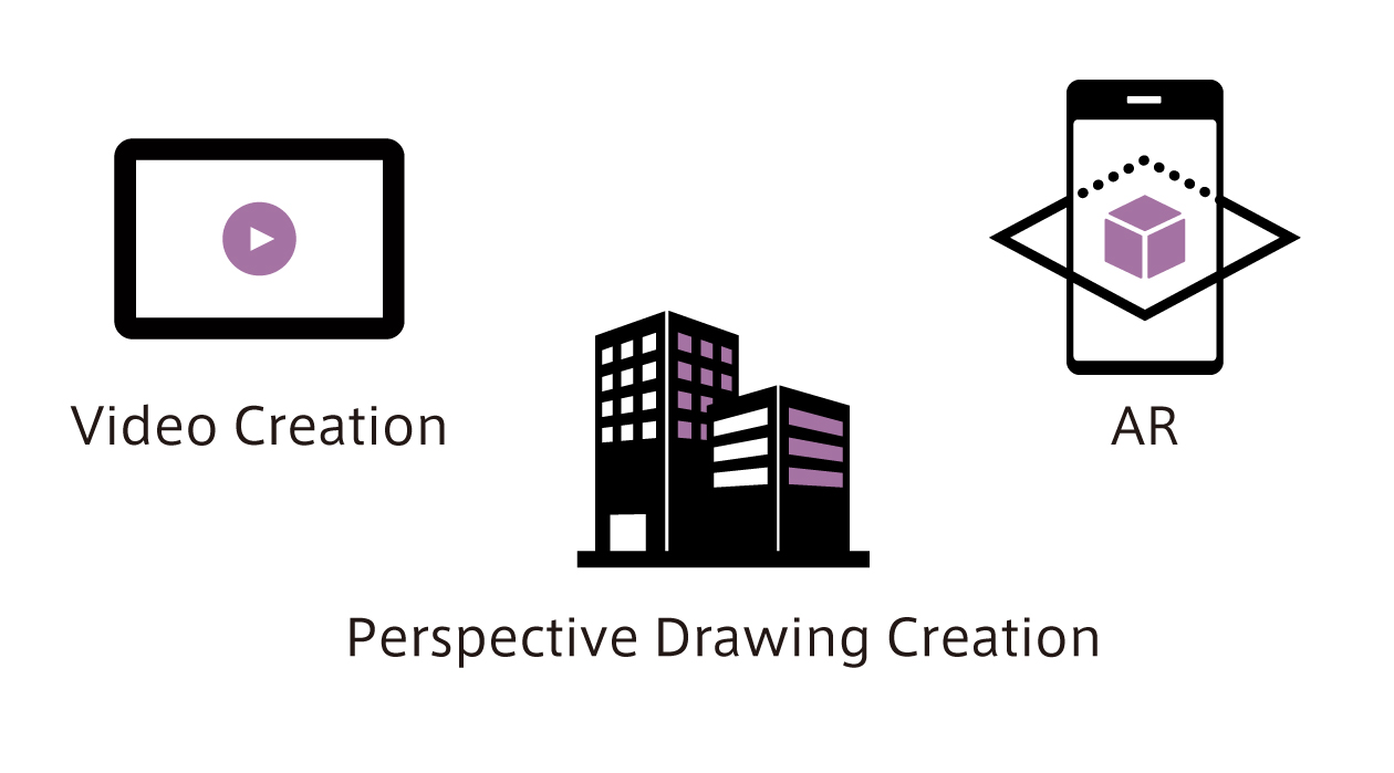
We can make your existing data clear and visually appealing.
We can create videos and perspective drawings for external communication purposes (stakeholder discussions, community explanations, public relations).
We can provide AR applications to represent your 3D data using devices.
▶ ForARapps Here
Perspective Drawing Creation
BIM/CIM applied to bridges, roads, rivers, architecture, etc. High quality based on standards We will create an image perspective drawing.
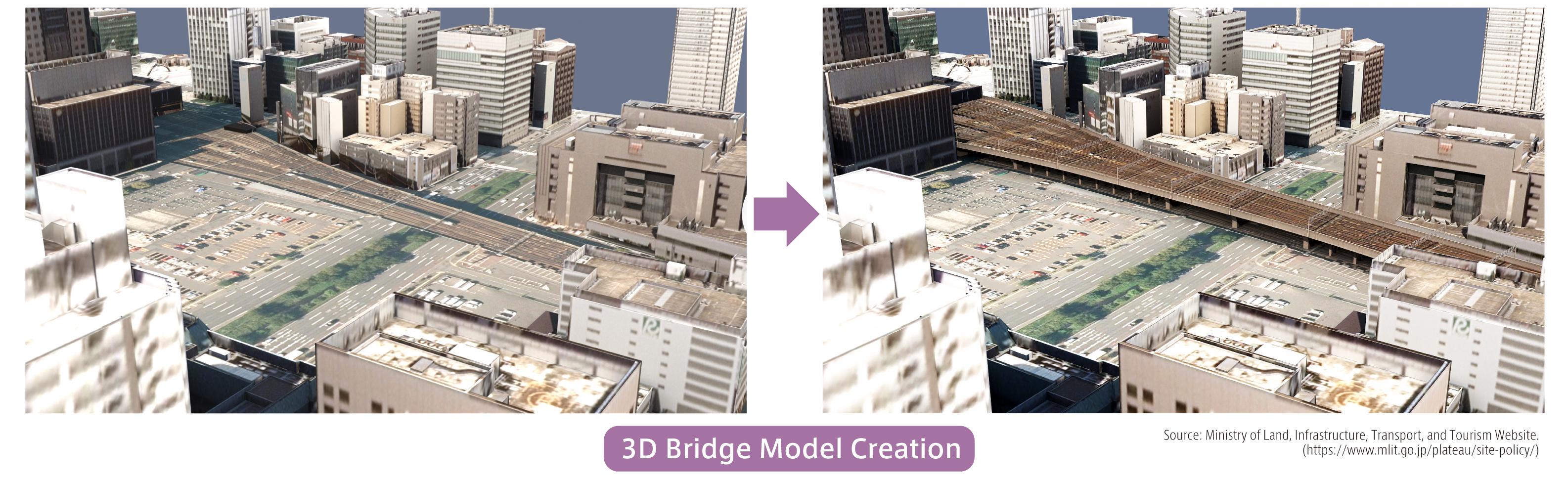
Utilization of BIM/CIM Data for Road Expansion Projects
Using 3D models allows information to be shared among stakeholders throughout the entire construction process, from planning to execution and maintenance.
We offer proposals for effectively utilizing BIM/CIM data.
KIMOTO360 / Eye-Con360 / TerraceAR
KIMOTO360
EDITOR&VIEWER
Using data captured using a 360° camera
You can freely move around the space.
Read more
Eye-Con360
You can visualize the site by combining 360° photos and 3D models.
Intuitive visualization software
Read more


KIMOTO360 EDITOR&VIEWER
This software allows you to navigate freely within spaces captured using a 360° camera.
It can be widely used for tasks such as design, maintenance, current status understanding, planning, renovation, education, and simulation support. Various files can be attached and viewed on the omnidirectional image, and the operation is simple with just a mouse. Since the file size is small, processing is fast and there is no need to connect to the cloud.

Assessment of Current Condition
It captures angles that cannot be captured with a regular camera, covering 360° in all directions, making it easier to understand the shooting locations even in structures with similar shapes or narrow spaces. Files attached to the omnidirectional image can be identified by the color of the file icon. Clicking on the file icon opens it, allowing you to check the contents.

Maintenance and Inspection
Even if you are not on-site, you can view the site from the same perspective as if you were at the actual location or facility. You can manage information for the entire area under management in one go, and it is also possible to search and compare large amounts of data.
KIMOTO360 EDITOR & VIEWER Eight Japan Technology Development Enhanced Functionality Edition


Data Management
You can freely change the shooting position and icon color, allowing you to visually understand, for example, by year or by importance.

Filing integration
A function has been added that allows you to check file icons from the shooting points before and after.

Eye-Con360
A new on-site support tool that allows you to freely place 3D models in 360° photos
It can be widely used not only by customers in the construction industry but also by customers in the manufacturing industry.

Usage scene
Preliminary Design
Disaster Recovery
New Construction Design
Hypothetical Design etc.
Main features
Easy to use for anyone
Simply drag and drop the 3D model onto the 360° photo
Easy sharing with lightweight data
The resulting data is lightweight and can be shared immediately as an email attachment
Judgment possible without going to the site
Accurately grasp the situation remotely, saving time and money
For inquiries Here from
TerraceAR
Experience AR easily using your iPhone or iPad with this construction-specific AR app.

Original 3D data created on siteARCan be placed as content.
You can also use it to streamline supervision and inspection using BIM/CIM and for external presentations.
Main Modes
Construction Planning Mode (Placement of 3D models, such as color cones, signs, and construction vehicles)
Survey Mode (Displays simple measurements and guides on-site)
BIM/CIM mode ( Align the design model with the exact location on site)
TerraceAR Utilization
Displays PLATEAU urban model data in AR.
Displays factory model data in actual size using AR.
KIMOTO's high-quality and high-value data services: Drawing on years of expertise and achievements
KIMOTO’s core technology, rooted in image processing since its founding, has evolved into geospatial information technology, combining the acquisition and editing of various information, such as location, space, and time. This single seamless technology has contributed to the development of regional and urban environments.
In the 5G era, high-quality data processing of real-world spaces and spatial information communication services using 360° images are being utilized in various fields, regardless of industry.
National and local public entities are working on national resilience and civil engineering.・In the fields of architecture and urban planning、Towards the realization of a society where real and virtual spaces are highly integrated, we offer a one-stop service from measurement to processing to viewing, based on years of accumulated know-how, creating high-quality, high-value data.

catalog
To request a catalogue Here from (Opens in a new window)
Related Services
Online Estimator (KIMOTO Online Quotation Service)
This service is intended for customers in Japan only.

Inquiries Regarding This Project
Contact form Here from (Opens in a new window)